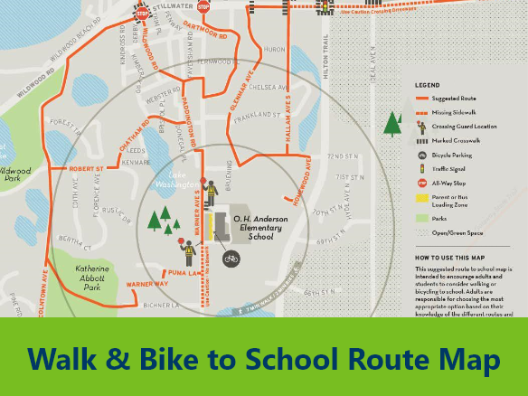
Walk and Bike Route Maps show stop signs, signals, crosswalks, sidewalks, paths/trails, crossing guard locations, and hazardous locations around a school. These can be used by families to identify the best way to walk or bike to school. District liability concerns are sometimes cited as reasons not to publish walking route maps. While no walking route will ever be completely free of pedestrian safety concerns, a well-defined route should provide the greatest physical separation between walking students and traffic, expose students to the lowest traffic speeds and use the fewest and safest roadway crossings.
Target Audience Elementary, middle school, high school, caregivers
Discussion Questions Are you aware of suggested walking and biking routes in your neighborhood? Would this resource be most valuable in print or online format?